BY Rajendra Prasad Adhikary
The British administration in India extensively utilised the water navigation route along the Ganga River as a cost-effective transportation method in northern and eastern India. This mode of transport benefited from the consistent water flow originating from the melting snow of the Himalayan rivers, including the Saptakoshi River in Nepal. As India's railway network expanded, the popularity of inland water transport on the Ganges gradually waned. However, discussions on river linking projects, designed to transfer water from water-abundant regions to water-deficient ones, has now taken centre stage in India's water resource planning. This strategic approach aims to reinvigorate old waterways, such as the ancient navigational route of the Ganges, as a cheap means of transport. (India Today, August 29, 2022 publication)
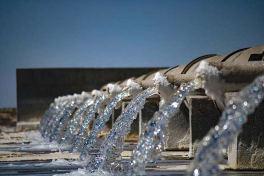
An impressive annual discharge of approximately 81.8 billion cubic metres from the Saptakoshi River, if channelised properly, could provide the necessary water depth for a navigational route connecting Chatara in eastern Nepal to the Indian Ocean seaport via the city of Patna in India. Given the historical and cultural significance of water navigation along the Koshi River and the recurring challenges posed by breaches in riverbanks during monsoon-triggered floods, there is an opportunity to transform the potentially disastrous Saptakoshi flooding into an advantageous navigational waterway. This transformation could play a pivotal role in driving socio-economic development within the region.
The history of the Saptakoshi River dates back to the formation of the Himalayas in the region. This river, fed by meltwater from the high Himalayan watershed, has been flowing for ages. The river was known as Koshi during the Vedic period, a name it received when Kauski, the daughter of sage Bishwamitra, met her end in its waters. It's referred to as Saptakoshi due to the convergence of its seven tributaries at Chatara, located ten kilometres north of the Nepal-India border, before ultimately meeting the Ganges. The river fostered agricultural-based civilizations and played a central role in water-centric Hindu rituals. However, the annual monsoon floods have perpetually posed challenges, causing loss of life, property, and fertile lands due to the uncontrolled and sand-laden surge of water across the river's floodplains.
The dynamic nature of the Saptakoshi River, characterised by its ability to alter its course and shift its flow path laterally, is attributed to its capacity to transport and deposit sand from the high mountains. This process elevates the plain and influences the direction of the river's flow. The volume of sediment carried by the river annually is substantial. According to a study conducted by the Second Irrigation Commission of Bihar, India in 1994, annual sediment load of the river is estimated to be nearly 92.5 million cubic metres. To put this into perspective, this volume is roughly two and a half times the length of the equator when visualised as a wall one metre high and one metre wide constructed from the accumulated sand deposits.
During the colonial period in India, the Sapta Koshi River presented a significant challenge to the British rulers. Although British revenue collectors were pleased with the bountiful crop production in the Koshi floodplain, they were frustrated by the recurring high floods that damaged crops and subsequently reduced their revenue collection. The British experts lacked experience in managing floods of this scale and nature, which made them hesitant to invest financially in flood control projects for the Koshi River.
The idea of constructing a high dam at Barahakshetra in Nepal to control the monsoon floods of the Saptakoshi River was strategically considered during British rule in India. In his book "Trapped between Devil and Deep Waters," DN Mishra mentions that the East India Company engaged in numerous correspondences with the Government of Nepal, seeking practical solutions for flood safety after finalising the historic Sugauli Treaty between the two governments. However, due to the formidable challenges posed by the intensity of monsoon rain-generated floods and the ever-shifting nature of the river's flow, the British administration did not pursue the construction of a high dam or flood-guiding embankments to safeguard the people living in the area. Instead, they colloquially referred to the river Koshi as the 'Sorrow of Bihar'.
Following the end of British rule in India, there emerged a collective aspiration among the Koshi flood victims to transform their flood-prone settlements into flood-protected areas. The concept of a Koshi flood embankment gained prominence in political discussions. A pivotal moment came when flood victims made strong demands for measures to control the flood with Indian Prime Minister Jawaharlal Nehru who had visited the flood-affected region to announce a relief package.
Under Nehru's leadership, a plan was devised to construct a 121 km long earthen embankment extending from the Nepal-India border near Bhardaha to Saharsa district in Bihar. This embankment would enclose the Koshi floodwaters and include a 4.8 kilometre long barrage with a 12.8 km afflux bund at Hanuman Nagar in Nepal. This plan was developed in accordance with the historical Koshi Treaty between the two governments. On December 13, 1953, Gulzari Lal Nada Prasad, a Member of Parliament, presented the proposal in the Indian Parliament.
This plan, often referred to as the 1953 Scheme of Koshi or the Central Water & Power Commission (CWPC) Plan 1953, gained widespread recognition. Before it's finalisation, a technical committee led by K.L. Rao and Kawar Sen, along with a team of American engineers, evaluated the earlier British proposal for a high dam at Barahakshetra in Nepal. They concluded that such a proposal was impractical due to the seismic sensitivity of Nepal and the Bihar state of India, which are located in a highly earthquake-prone zone. The collapse of a flood water-retaining high dam could have disastrous consequences, submerging vast settlements in northern Bihar and the eastern Terai region of Nepal. In conjunction with the construction of elevated riverbanks for flood protection, efforts were made to provide irrigation water to both Nepal and India. This was achieved through the construction of the Chatara canal in Nepal and the Eastern Koshi main canal in India.
But the Koshi plan could not contain the floods. The earthen dykes along the banks were soon filled by sand deposits which caused water levels to rise. As a result, the river breached its banks in every monsoon rain. The Indian flood recording system recorded high flood events in the river at least once every five years. The flood measuring 235,070 cusec in July 14, 2008 which breached the eastern embankment in Nepal side to gush flood through its previous 100 years old flow channel, affected about 2.64 million people in Bihar state of India. Similarly, the flood affected 65,000 people in Nepal, damaged roads and bridges, and destroyed 700 hectares of fertile land in Sunsari and Morang districts of eastern Nepal. The Asian Development Bank estimated that the floods resulted in 0.3 percent GDP loss to Nepal in that fiscal year.
In the current context, where flood-related devastation has been exacerbated by the intensified impact of climate change-induced localised rainfall, particularly pronounced in the Himalayas, the flood protection infrastructure of the Koshi project from 1953 finds itself insufficient to safeguard adjacent settlements. The Koshi barrage, which is over six decades old and was initially designed to withstand the most severe floods, is now underperforming due to reduced capacity caused by sand accumulation. It vibrates significantly, hindering its ability to cope even with the average annual monsoon flood. Similarly, the earthen embankment has proven ineffective at retaining floodwater in numerous areas due to the ongoing changes in the river's flow path. Riverbed in many places has risen above adjoining settlements, significantly increasing the risk of flooding in the event of an embankment breach. The looming climate crisis, coupled with the potential for cloud bursts in the watershed, poses the grim potential for even larger flood disasters that could result in the loss of several thousand human lives, as well as significant damage to infrastructure and agricultural land.
The much-talked-about Koshi high dam project has not yet revealed a pragmatic solution in controlling floods and utilising the Koshi waters, despite having a Nepal-India joint project office in Biratnagar, Nepal. The recent developments in water resources planning in India, where the National Institute of Hydrology India is formulating river water management plans - such as the river linking project, Himalayan water linking, river water transport from water surplus basins to water-scarce basins, and reviving the old waterways for inland transport - are the priority water resources development schemes.
With all the historical background of the Saptakoshi river, coupled with several analogies drawn from international agreements on trans-boundary rivers, Nepal can extract optimum benefits from the waters of Saptakoshi, particularly in flood safety, irrigation benefits, hydropower production, and uninterrupted year-round waterway access from eastern Nepal to the nearest seaport at the Bay of Bengal via the Ganges.
(Adhikary is an engineer and served Nepal government in various high level capacities.)